Verified Views by Eye-Kon
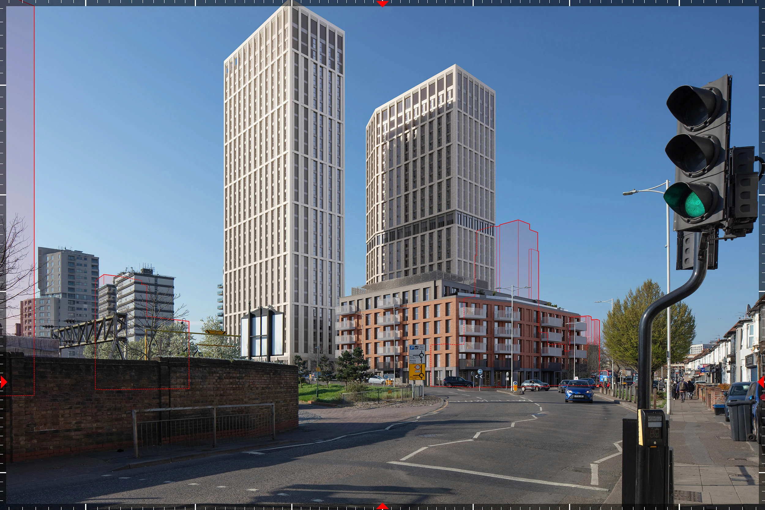
Accurate TVIA Visuals
Compliant LVIA Solutions
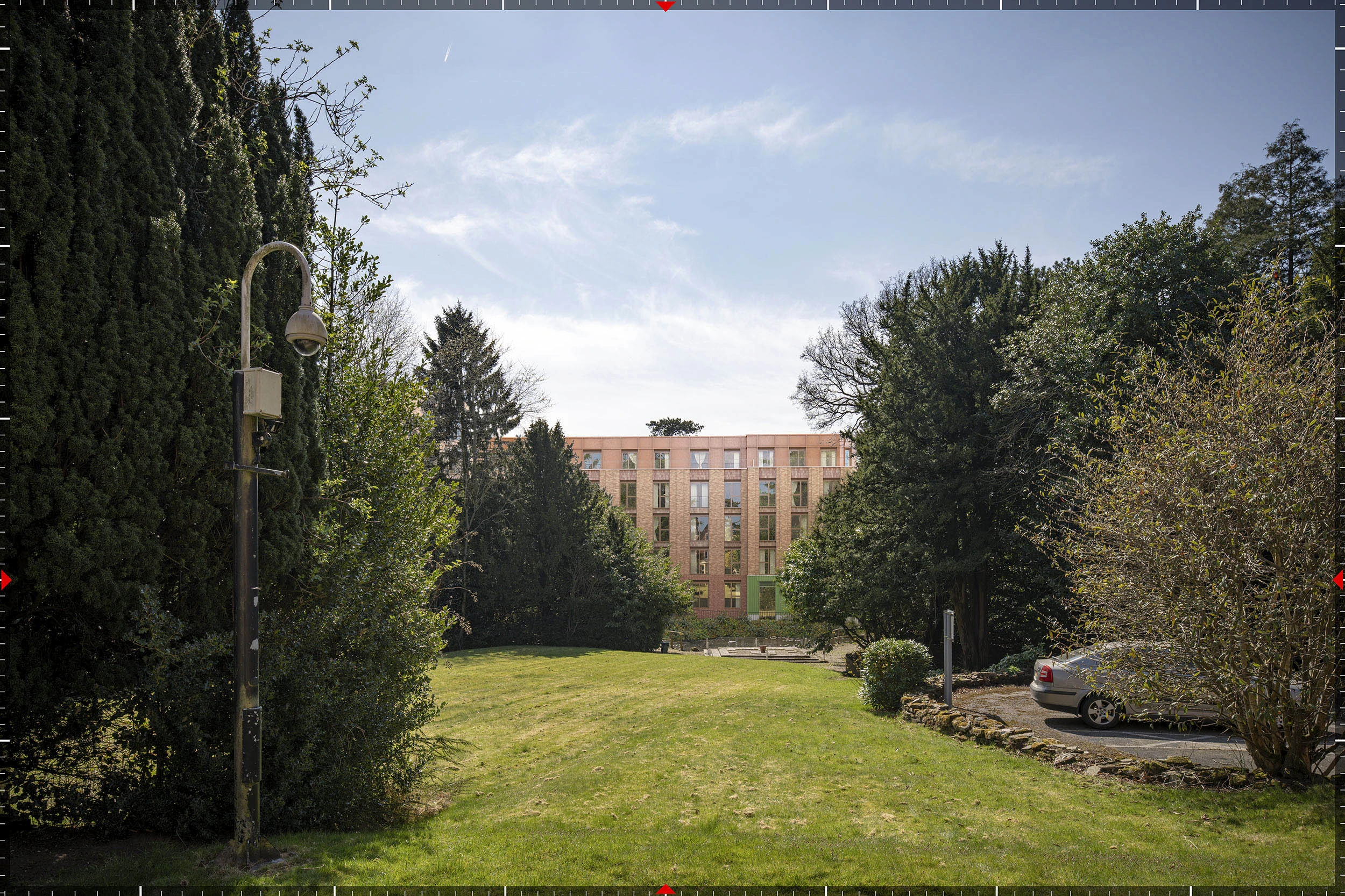
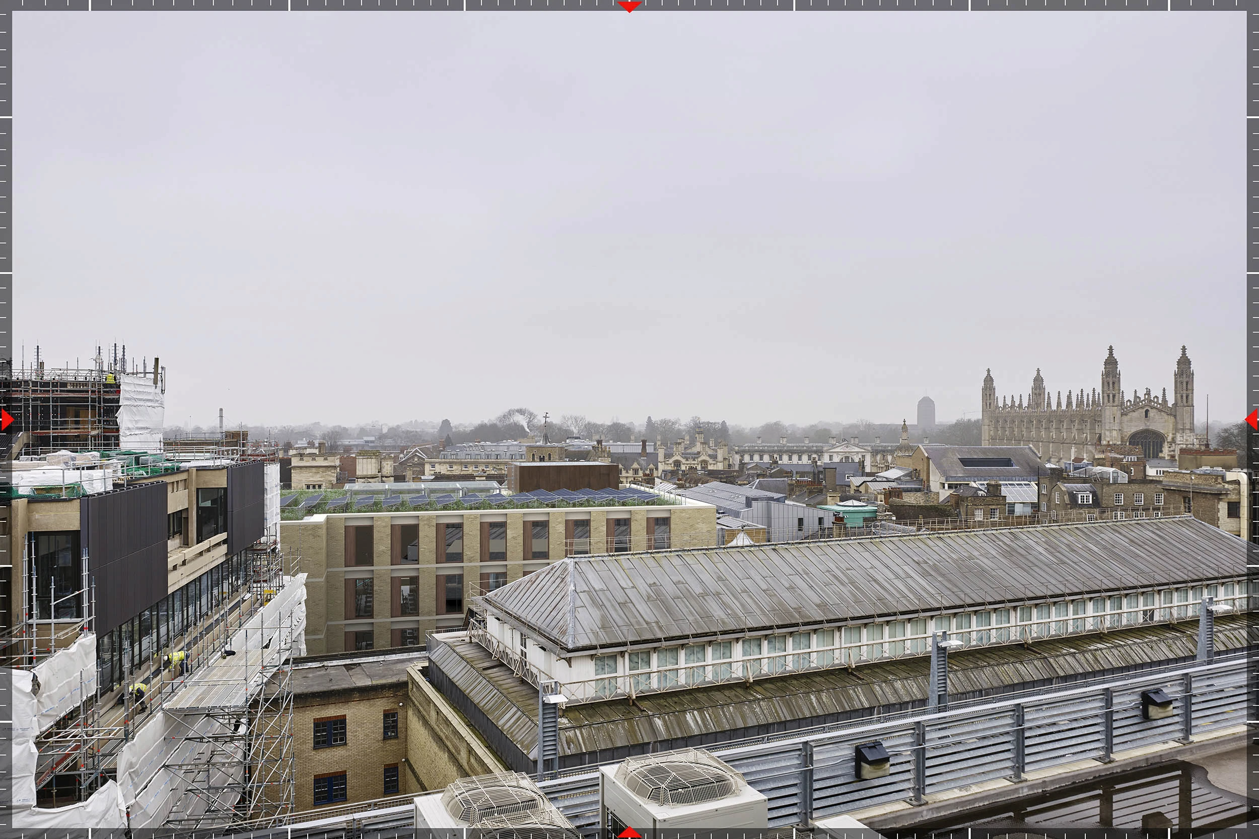
Sensitive Heritage Contexts
Eye-Kon is an architect-led studio specialising in production-accurate Verified Views.
We produce fully compliant Verified View Montages (VVMs) in accordance with the London View Management Framework (LVMF) and Landscape Institute Technical Guidance (TGN 06/19) – delivering the technical precision required to withstand planning, heritage and committee scrutiny.
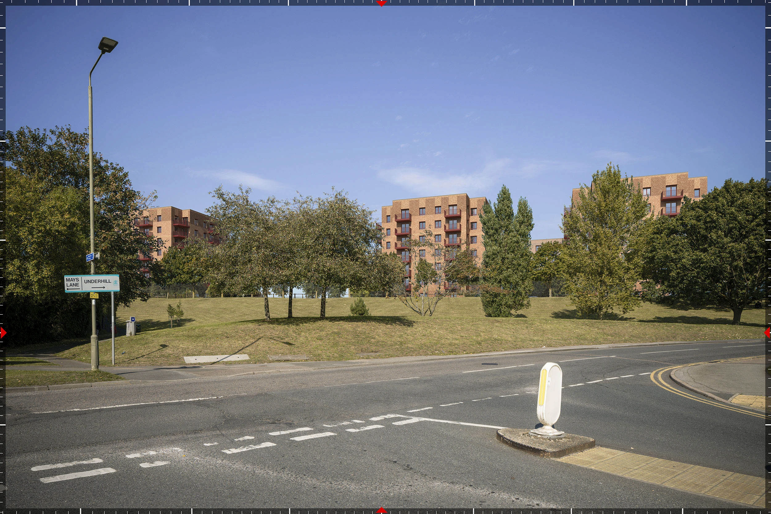
Working nationwide, we support Townscape (TVIA), Landscape (LVIA) and Heritage Impact Assessments (HIA) for developers, architects and planning consultants.
Eye-Kon is an architect-led studio specialising in production-accurate Verified Views.
We produce fully compliant Verified View Montages (VVMs) in accordance with the London View Management Framework (LVMF) and Landscape Institute Technical Guidance (TGN 06/19) – delivering the technical precision required to withstand planning, heritage and committee scrutiny.
Working nationwide, we support Townscape (TVIA), Landscape (LVIA) and Heritage Impact Assessments (HIA) for developers, architects and planning consultants.










Our Portfolio
AVR & Verified View Case Studies
Explore our nationwide portfolio of compliant verified views and AVRs across the UK.
Our Portfolio
AVR & Verified View Case Studies
Explore our nationwide portfolio of compliant verified views and AVRs across the UK.


Methodology & Compliance
The Standards Behind Our Work
Methodologically sound, completely auditable, and built to withstand the scrutiny of local planning authorities
Methodology & Compliance
The Standards Behind Our Work
Methodologically sound, completely auditable, and built to withstand the scrutiny of local planning authorities
Architect-led Precision
Our work is led by qualified architects with over 20 years’ experience producing Accurate Visual Representations. We understand design intent as well as technical compliance, ensuring every view is both architecturally accurate and technically robust.
Architect-led Precision
Our work is led by qualified architects with over 20 years’ experience producing Accurate Visual Representations. We understand design intent as well as technical compliance, ensuring every view is both architecturally accurate and technically robust.
Full LPA and LVMF Compliance
All verified views are produced in accordance with the London View Management Framework (LVMF) and Landscape Institute Technical Guidance (TGN 06/19). We deliver planning-ready visuals designed to withstand officer and committee scrutiny.
Full LPA and LVMF Compliance
All verified views are produced in accordance with the London View Management Framework (LVMF) and Landscape Institute Technical Guidance (TGN 06/19). We deliver planning-ready visuals designed to withstand officer and committee scrutiny.
Survey-integrated Accuracy
We align 3D models to GPS-synchronised survey data, ensuring precise correspondence between model and photography. Every camera position, lens specification and coordinate is recorded and fully traceable.
Survey-integrated Accuracy
We align 3D models to GPS-synchronised survey data, ensuring precise correspondence between model and photography. Every camera position, lens specification and coordinate is recorded and fully traceable.
Transparent, Auditable Methodology
Each commission is supported by a clear and comprehensive methodology report documenting camera locations, surveyed control points and technical parameters for Local Planning Authority review.
Transparent, Auditable Methodology
Each commission is supported by a clear and comprehensive methodology report documenting camera locations, surveyed control points and technical parameters for Local Planning Authority review.
Proven Performance on Sensitive Sites
We have a strong track record delivering verified views for developments within conservation areas and heritage-sensitive contexts, where visual impact is critical to approval.
Proven Performance on Sensitive Sites
We have a strong track record delivering verified views for developments within conservation areas and heritage-sensitive contexts, where visual impact is critical to approval.

Professionally Insured
Eye-kon carries £4 million professional indemnity insurance, providing the level of protection required for major UK planning applications.
Professionally Insured
Eye-kon carries £4 million professional indemnity insurance, providing the level of protection required for major UK planning applications.
Frequently Asked Questions
Clear Answers on AVR Process
Answers to standard technical procedures, from data requirements to final delivery levels.
Frequently Asked Questions
Clear Answers on AVR Process
Answers to standard technical procedures, from data requirements to final delivery levels.
We typically require the proposed design in 3D format (Revit, SketchUp, Rhino or similar), a topographical survey in DWG format, site address and planning context, and confirmation of agreed viewpoints if available. If viewpoints have not yet been agreed, we can assist in early-stage selection alongside your planning consultant.
Most commissions take between 2 and 4 weeks, depending on the number of viewpoints, site access requirements and complexity of the surrounding context. Early engagement helps streamline programme and avoid abortive work.
Yes. Our visuals are technically robust for planning submission while remaining clear and accessible for public exhibitions, consultation boards and committee presentations.
Absolutely. We regularly collaborate with planning consultants, townscape specialists and landscape architects to ensure that all views align with TVIA, LVIA and HIA requirements and Local Planning Authority expectations.
Our views are based on survey-verified camera positions and GPS-aligned 3D models. Lens type, focal length and camera height are recorded and documented, producing defensible visual evidence suitable for planning scrutiny. Find out more
Yes. Our visuals are technically robust for planning submission while remaining clear and accessible for public exhibitions, consultation boards and committee presentations.
Yes. Provided the camera position and survey alignment remain unchanged, we can update the 3D model and regenerate the views without repeating photography or surveying.
Yes. Each project includes a clear, auditable methodology statement documenting camera coordinates, surveyed control points, lens data and technical process, in line with Landscape Institute guidance.
Yes. Our methodology complies with the London View Management Framework (LVMF) and Landscape Institute Technical Guidance Note 06/19. Where required, we also align with Historic England guidance and local policy.
Yes. Although based in London, we operate nationwide and regularly deliver verified views across the UK.
Yes. Eye-kon carries £4 million Professional Indemnity Insurance, providing appropriate cover for major and sensitive planning applications.
Yes. Eye-kon carries £4 million Professional Indemnity Insurance, providing appropriate cover for major and sensitive planning applications.
We typically require the proposed design in 3D format (Revit, SketchUp, Rhino or similar), a topographical survey in DWG format, site address and planning context, and confirmation of agreed viewpoints if available. If viewpoints have not yet been agreed, we can assist in early-stage selection alongside your planning consultant.
Most commissions take between 2 and 4 weeks, depending on the number of viewpoints, site access requirements and complexity of the surrounding context. Early engagement helps streamline programme and avoid abortive work.
Yes. Our visuals are technically robust for planning submission while remaining clear and accessible for public exhibitions, consultation boards and committee presentations.
Absolutely. We regularly collaborate with planning consultants, townscape specialists and landscape architects to ensure that all views align with TVIA, LVIA and HIA requirements and Local Planning Authority expectations.
Our views are based on survey-verified camera positions and GPS-aligned 3D models. Lens type, focal length and camera height are recorded and documented, producing defensible visual evidence suitable for planning scrutiny. Find out more
Yes. Our visuals are technically robust for planning submission while remaining clear and accessible for public exhibitions, consultation boards and committee presentations.
Yes. Provided the camera position and survey alignment remain unchanged, we can update the 3D model and regenerate the views without repeating photography or surveying.
Yes. Each project includes a clear, auditable methodology statement documenting camera coordinates, surveyed control points, lens data and technical process, in line with Landscape Institute guidance.
Yes. Our methodology complies with the London View Management Framework (LVMF) and Landscape Institute Technical Guidance Note 06/19. Where required, we also align with Historic England guidance and local policy.
Yes. Although based in London, we operate nationwide and regularly deliver verified views across the UK.
Yes. Eye-kon carries £4 million Professional Indemnity Insurance, providing appropriate cover for major and sensitive planning applications.
Yes. Eye-kon carries £4 million Professional Indemnity Insurance, providing appropriate cover for major and sensitive planning applications.
Talk to Us about your Project
If you are preparing a planning application, a LVIA, TVIA or HIA, or require technically robust Verified Views (AVRs), we would be pleased to assist. Get in touch for a clear, straightforward discussion about your project, planning requirements and programme.

Talk to Us about your Project
If you are preparing a planning application, a LVIA, TVIA or HIA, or require technically robust Verified Views (AVRs), we would be pleased to assist. Get in touch for a clear, straightforward discussion about your project, planning requirements and programme.
Talk to Us about your Project
If you are preparing a planning application, a LVIA, TVIA or HIA, or require technically robust Verified Views (AVRs), we would be pleased to assist. Get in touch for a clear, straightforward discussion about your project, planning requirements and programme.
Technical Insights
Verified Views : Process Methodology
Technical resources breaking down the methodologies behind our Accurate Visual Representations.
Technical Insights
Verified Views : Process Methodology
Technical resources breaking down the methodologies behind our Accurate Visual Representations.